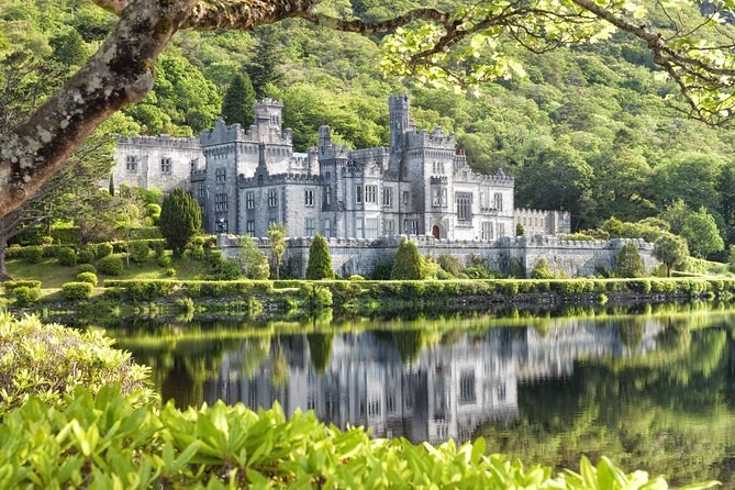
Connemara Day Trip Including Leenane Village and Kylemore Abbey from Galway
Leenane and Killary on the way out, two hours at Kylemore with the estate ticket paid, and back to Galway by Spiddal.
From $76 per person
Check AvailabilityThe abbey is one stop on a long loop of Connemara road, and the estate itself spreads over 1,000 acres. Choosing your Kylemore Abbey tour? Here is where it sits, and how the estate lies once you are through the gate.
Kylemore Abbey, Connemara
On the N59,
3 km from Letterfrack
The abbey stands on the N59 in the north-west corner of County Galway, 20 km from Clifden and 80 km from Galway city. Westport, in County Mayo, is 50 km to the north-east, by Leenane and Killary Harbour.
The Eircode is H91 VR90. The mountains around it frame the view: Duchruach rises straight behind the abbey, and the Diamond faces it from the south, across the valley in Connemara National Park.
The abbey publishes an estate map, a ground-floor plan of the abbey and a map of the walled garden. Download them before you go if you want to plan your route in advance.
The woodland and river walks spread out from the main avenues. The Tree Trail follows the avenues themselves, so you walk part of it on your way to the church without trying.
Dawros River Walk: 1 km, about 30 minutes on a gravel path. It follows the river from Kylemore Lough towards the Atlantic, with three viewing points on the way.
Horsechestnut Loop: 200 m, about 5 minutes, through a tunnel of trees and past the pony paddock. It is the one to pick with small children.
Sruffaunduff Waterfall: one of the largest falls on the estate. It runs hardest after rain, so a wet morning is the time to see it.
Duchruach: the mountain behind the abbey. You can only climb it on a guided hike, and the hikes are on hold.
What each walk shows you is on things to see at Kylemore Abbey.
Every Galway day tour drives a loop through Connemara, and each one takes a different road. The table follows each day's own itinerary.
| Galway day | The road out | The road back |
|---|---|---|
| Leenane day (Lally Tours) | Oughterard, Maam Cross and the Twelve Bens, then Leenane and Killary | Past the national park, with a break at Spiddal, then Salthill |
| Cong day (Galway Tour Company) | The Inagh Valley, straight to Kylemore | Killary, the Lough Nafooey road, then 45 minutes in Cong |
| Abbey-or-park day (Wild Atlantic Way Day Tours) | Screebe waterfall, Pine Island, then Clifden and the Sky Road | Lough Inagh and the Connemara Giant |
If you drive yourself, the N59 through Oughterard and Maam Cross is the direct road, 80 km and about 1 hour 15 minutes. Directions for each approach are on how to get to Kylemore Abbey.
Match the first column to where you are staying. Most days start in Galway city, at one of two kerbs.
| Where the day starts | Which tours |
|---|---|
| HYDE Hotel, Forster Street, Galway | Lally Tours' Leenane and sheepdog days |
| Kinlay Hostel, Merchants Road, Galway | The Cong days and the abbey-or-park days |
| Your hotel in Galway | The private cars from Galway |
| Westport or Ballina | The private day from County Mayo |
| Dublin | The rail tour, the 2-day private tour and the 10-day tour |
Compare the days that begin there, with the time at the abbey and the ticket shown on every card.
These are the stops you will see named in the itineraries, in the order you meet them coming from Galway.
Letterfrack: the village about 3 km from the abbey. The national park's visitor centre is just outside it, on the Clifden road.
Clifden and the Sky Road: the town 20 km away, and the cliff road that loops out beyond it. The abbey-or-park days stop here, and so do some of the private cars.
Leenane and Killary Harbour: on the N59 towards Westport. The abbey calls Killary Ireland's only true fjord, and the Leenane day gives you a stop at each.
Cong: the village just over the border in County Mayo, with its abbey and the monks' fishing house on the river. The Cong days give you 45 minutes there.
Connemara National Park begins across the lough from the abbey. Some days from Galway ask you to choose the park or the abbey for their three-hour stop.
Distances, the Eircode and the estate layout come from the abbey's own pages, read in 2026. Routes and start points come from each tour's own itinerary.
Leenane and Killary on the way out, two hours at Kylemore with the estate ticket paid, and back to Galway by Spiddal.
From $76 per person
Check Availability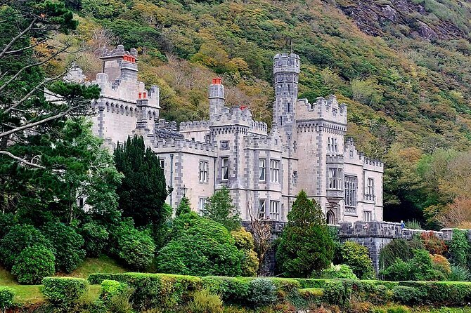
A private guide from Galway for a group of up to three: two hours at Kylemore, an hour at Aughnanure Castle and two at the Killary Sheep Farm. Entries are extra.
From $878 per group, up to 3
Check Availability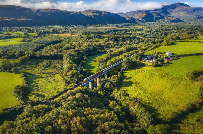
Eight days by private train from Connolly Station in Dublin, June or September, with two hours at the abbey and garden and every admission in the fare.
From $6,344 per person
Check AvailabilityNext: plan the drive on how to get to Kylemore Abbey, pick your month on Kylemore Abbey weather, or compare every day out on Kylemore Abbey Tours.